
shifting Arctic boundaries
Year
2022
Shifting arctic boundaries like changing models of thinking
This project looks critically to one of the latest colonization projects on the planet - the appropriation of local resources and development of the arctic zone. This touches upon a very challenging theme of indigenous cultures and the confrontation between contrasting notions of territory by the so-called «western» thinking and indigenous thinking. Our project intends to produce a designed mechanism,-based on a variety of existing and designed physical boundaries, by which land management, the introduction of new land usages and their seasonal changing boundaries , can be accessed, built and negotiated by relevant local actors/people.
We chose Tommerneset peninsula in Northern Norway as our study area, where four new big port developments are now planned and where anticipated disruptions in the historically Skolt Sami territory will need to be addressed for the foreseeable future.

Physically, these boundaries could translate to fences, floating buoys, or visual markings on the landscape to denote changing zones. As port construction phases complete, our model re-runs to optimize remaining space—suggesting locations to condense operations and reduce environmental impact .
By making invisible territory contested and transformable, our project encourages inclusive land negotiations with Sami communities, developers, and local authorities. It’s not a static plan—it’s an evolving protocol for adaptive, negotiated Arctic land management.


Our response was to create Cartogenesis—a rule-based mapping tool that applies "patches" of boundary types tailored to local conditions. Each patch includes rules for who can build, when, and how strongly boundaries are enforced. These change dynamically with sliders controlling seasonal shifts and with new infrastructure timelines.
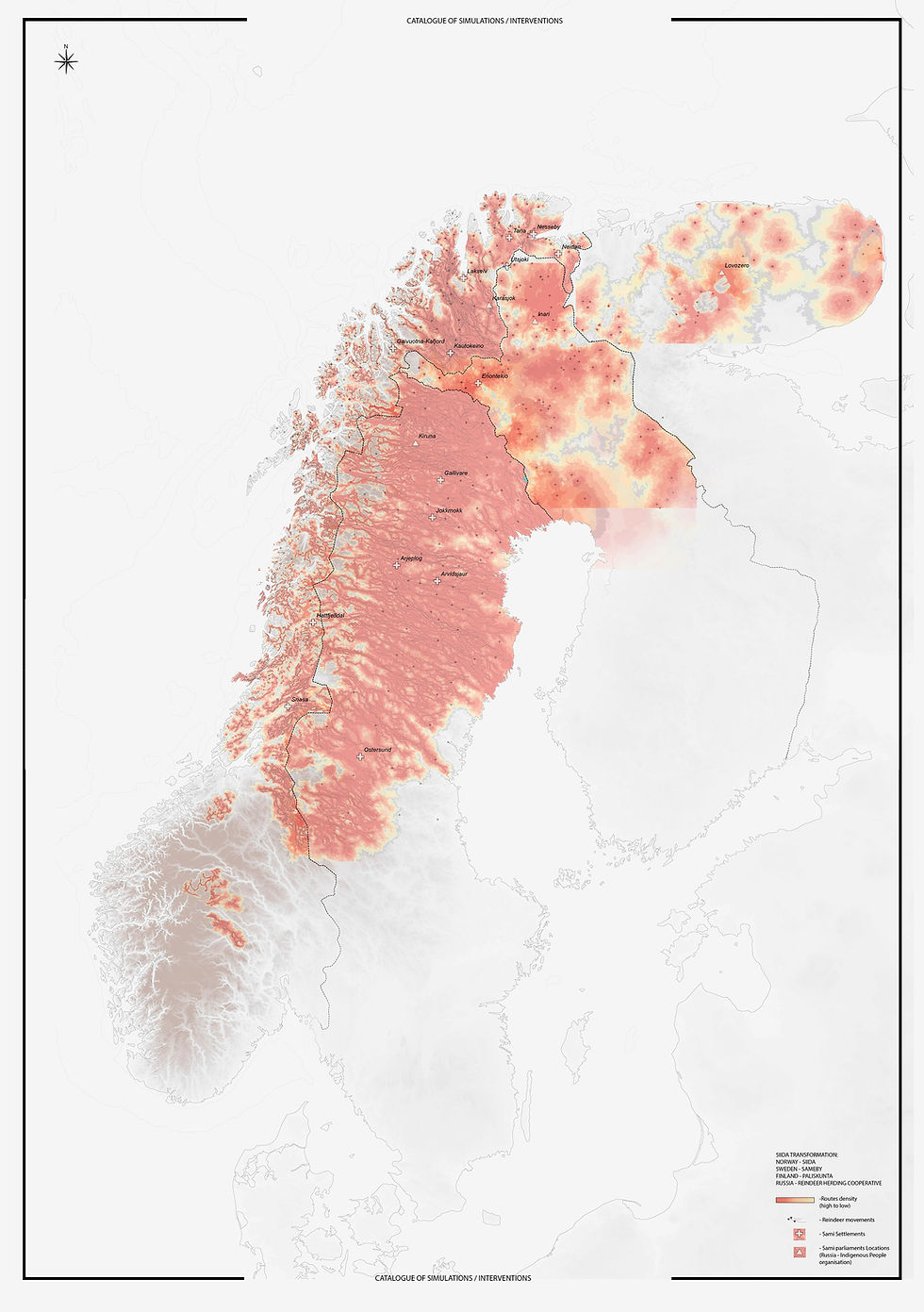
To understand the competing claims, we researched how five main actors operate throughout the year: Skolt Sami reindeer herders (summer and winter siidas), future port developers, military training zones, tourism operators, and the local airport. Seasonal maps reveal how each group occupies and uses land differently across seasons.

The Arctic is changing fast—and with it, the way land is claimed and used. Shifting Arctic Boundaries tackles this by focusing on the Tommerneset peninsula, where rapid infrastructure expansion threatens centuries-old Sami migration routes and land rights.
technical facts
-
Designers: Panagiota Fyta & Nataly Khadziakova
-
Program: AA Landscape Urbanism (2016)
-
Study Area: Arctic Pole/Saami Land/Tommerneset peninsula, Northern Norway